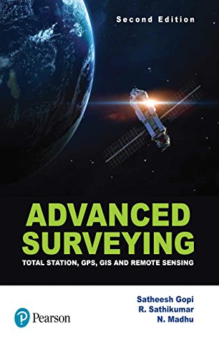
Advanced Surveying, 2e
Extensively revised and updated, the second edition of Advanced Surveying includes the latest advancements and instruments in the field such as total station, electronic distance measuring (EDM), GPS and LIDAR. The modern trends of remote sensing and GIS are presented with several case studies. A must-have for all undergraduate students of civil engineering! Practicing engineering and students studying geoinformatics/geomatics will also find the book extremely useful.
Features :
- New Chapters on Basics of Global Positioning Systems and Surveying Using Global Positioning Systems
- New Chapter on Spatial Analysis discussing classification of analytic functions of a GIS and overlay function.
- New Appendix A deals with the basic geodetic aspects required for GPS-based surveying
- New Appendices B–D provide step-by-step field procedure of various models of total stations
- Covers modern surveying instruments such as automatic levels, digital levels, micro-optic theodolites, LIDAR, digital plan meters and laser levels
- Dedicated Chapter on Applications of GIS with inclusion of new case studies
Table of Contents :
- Chapter 1 Fundamental Concepts of Geographic Information System
- Chapter 2 GIS Data Models
- Chapter 3 Data Acquisition
- Chapter 4 Maps and Map Projections
- Chapter 5 The Coordinate System
- Chapter 6 Spatial Analysis
- Chapter 7 Application of GIS
- Chapter 8 Basics of Total Station
- Chapter 9 Electronic Distance Measurements
- Chapter 10 Surveying Using Total Station
- Chapter 11 Data Collection Procedures
- Chapter 12 Automatic Level, Digital Level and Optical Theodolites
- Chapter 13 Aerial Surveying
- Chapter 14 Fundamentals of Remote Sensing
- Chapter 15 Basics of Global Positioning System
- Chapter 16 Surveying Using Global Positioning System
| Book | |
|---|---|
| Author | Gopi |
| Pages | 488 |
| Year | 2017 |
| ISBN | 9789352860722 |
| Publisher | Pearson |
| Language | English |
| Uncategorized | |
| Edition | 2/e |
| Weight | 300 g |
| Dimensions | 20.3 x 25.4 x 4.7 cm |
| Binding | Paperback |


